MetService has added the Wellington area and Kapiti Coast to its heavy rain warning for tomorrow.
Rain is expected to become heavy at times from the early hours of Friday until Friday night. In the 20 hours from 2am to 10pm Friday, expect 60-90mm of rain in places. Peak rates could reach 10-15mm per hour late morning and early afternoon.
Rainfalls of this amount has the potential to cause rivers and streams to rise rapidly, and lead to surface flooding and slips. Driving conditions could also become hazardous at times. People, especially holidaymakers, should keep up to date with the latest forecasts and warnings, and plan accordingly.
We have our fingers crossed for Nelson.
Thursday, December 29, 2011
Wednesday, December 21, 2011
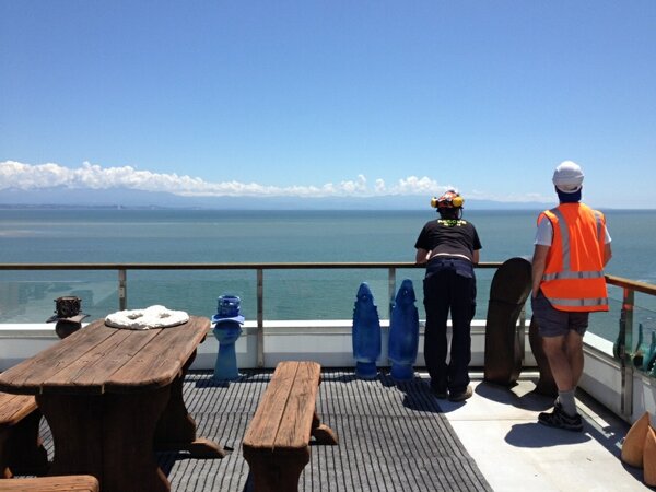
Porirua's Red Cross team deployed to Nelson
Porirua's Red Cross Response Team is lending a hand down in Nelson.
They headed over this morning, and today they have been assisting those who have been forced out of their homes to go back in in 30 minute stints to collect their belongings. They are working in teams with geotechnical engineers, civil defence and rescue team members to make sure the site is secure before going in.
Such a lovely view from this house -

But then you have a look out the back, just up the hill....

They headed over this morning, and today they have been assisting those who have been forced out of their homes to go back in in 30 minute stints to collect their belongings. They are working in teams with geotechnical engineers, civil defence and rescue team members to make sure the site is secure before going in.
Such a lovely view from this house -
But then you have a look out the back, just up the hill....

Thursday, December 15, 2011
Everywhere you go, always take the weather with you
Now I've got the Crowded House song stuck in my head...
I'm betting there are a few people in Nelson wondering who brought the weather with them on holiday, and hoping they could take it away again.
http://www.stuff.co.nz/national/6141806/Tales-of-destruction-as-flooding-sweeps-Nelson
A State of Emergency has been declared to help manage the response to the flooding and slips.
It makes you think, doesn't it? Could that happen where you're going on holiday this Christmas?
Is your favourite camping spot on a river flat which could flood? Are you tramping through an area where you'd have to cross streams or rivers?
What about other hazards? Is the bach in a tsunami evacuation zone, or in an area with a high fire danger?
I know it's a bit doom & gloom for what is supposed to be happy time of year, but unfortunately there are plenty of things that could go wrong while you are on holiday. Fortunately you can reduce your risks with some careful planning, and some of the same basic things that you do to prepare at home.
Know your risks - ask the local district council of the place you are going to.
Have a plan & learn where the important facilities are - medical centres etc
Take extra water and survival items with you. Something to keep the kids entertained in the car definitely counts as a survival item. Bored kids is a disaster on its own!
Tuesday, December 13, 2011
What do you do when the lights go out?
Parts of Auckland, Wellington & the Hutt Valley are currently without power, apparently due to some kind of fault at the Huntly power station.
Porirua is unaffected so far, though I make no garrantees that will continue!
EDIT: Doh! My bad. While the CBD has had no interruptions, it looks like most of the rest of Porirua has no power! We now have reports of outages in Aotea, Ascot Park, Waitangirua, Cannons Creek & Whitby.
Does your business rely on having a power supply to remain open?
Or have you got a back up plan?
A generator maybe, or gas for cooking if that's what your business involves - cafes in Wellington that cook with gas do a roaring trade during power cuts, as the office workers leave their buildings when they have no way to work without power.
Things you can do that don't require power - paper-based systems etc, or good batteries on a laptop. Some way to process eftpos & credit card transactions that doesn't rely on being plugged into the mains.
All things that you may want to think about for keeping your business going - especially at such a busy time of year.
Thursday, December 8, 2011
Shaking again
Once again we are reminded that the Wellington region is carved up by a large number of fault lines, with an earthquake measuring 4.2 triggered just 10km West of Porirua at 10:16 this morning.
It was quite noticeable at the Emergency Management Office - the initial rumble of the primary waves felt and sounded like someone was parking a Mack truck under the floor, and then the secondary waves hit with a definite side to side shaking.
Here's the Stuff article - http://www.stuff.co.nz/dominion-post/news/6106968/4-2-quake-hits-Porirua
Here's the data from Geonet:
The following earthquake has been recorded by GNS:
Reference number: 3623397/G
Universal Time: 2011/12/07 21:16:42
Local time (NZDT): 10:16 AM on Thursday 08 December 2011
Latitude, Longitude: 41.15S, 174.75E
NZ Map Grid (E, N): 2657000, 6005000
NZ Trans Merc (E, N): 1747000, 5443000
Location: 10 km west of Porirua
Focal depth: 30
Magnitude: 4.2
Web page: http://www.geonet.org.nz/earthquake/quakes/3623397g.html
Felt widely around the Wellington region
Click on the link, check out some of the maps and things, and fill in the Felt Earthquake Report.
Saturday, December 3, 2011
Did the earth move for you?
Much of the central part of the country had a good shake earlier this evening, when a magnitude 5.7 quake struck 30km east of Picton at 7:19pm. Fortunately it was located about 60km down, so it has only caused some minor damage - some people have lost a few ornaments (I can't recommend Fix, Fasten & Forget enough!), and it looks like the Meridian building in Wellington had some minor damage to its louvres.
Drop, Cover & Hold is still the best advice.
I'm a bit worried that people in a cafe in Picton ran out into the street during the shaking - some of the fatalities and injuries in the Christchurch quake were from falling debris hitting people who had run out of buildings. If you are inside a building when the shaking starts, it's safest to stay inside, and take shelter under something. if you are outside, stay outside and move away from the buildings, as things may be falling off them. What you don't want to be doing is heading out the door and passing through an area of significant danger.
Wednesday, November 30, 2011
Storing water - now would be a good time
The water that comes from your tap in Porirua has a remarkably long journey. It comes all the way from the Stuart Macaskill storage lakes at Te Marua, north of Upper Hutt, where the water was collected from the river. It's treated to make it clean and safe, and then heads down the valley (across the Wellington Fault in a couple of places) to a pumping station at Haywards, where it is pushed up and over the hill to flow on down to Porirua's reservoirs.
Currently, one of those storage lakes is completely empty.Greater Wellington is upgrading the sourthern lake this summer, to improve its strength in an earthquake, and also increase its capacity. The northern lake will be emptied and upgraded next summer. But in the meantime, it means that we have half the water stored in the system than we usually have.
This is likely to mean water restrictions as summer progresses, but it also means that now is a very good time to have more water stored in your own home for a unfortunate day when nothing comes out of the tap.
The warmer weather means that you'll probably be having lots of cold refreshing drinks - the kind that come in nice 1.5 or 3 litre clear plastic bottles - perfect for storing water! Instead of chucking the empty bottle in the recycling bin, clean it out, fill it to the top from the cold tap until it overflows, pop the lid on, and put it somewhere cool and dark out of your way. Tada! You've got some more water stored!
If the only refreshing drinks you have come in cans, glass, or milk bottles, then you can always buy some of our 10L water containers to store water in. They are just $5 each from the council office in Cobham Court.

Currently, one of those storage lakes is completely empty.
This is likely to mean water restrictions as summer progresses, but it also means that now is a very good time to have more water stored in your own home for a unfortunate day when nothing comes out of the tap.
The warmer weather means that you'll probably be having lots of cold refreshing drinks - the kind that come in nice 1.5 or 3 litre clear plastic bottles - perfect for storing water! Instead of chucking the empty bottle in the recycling bin, clean it out, fill it to the top from the cold tap until it overflows, pop the lid on, and put it somewhere cool and dark out of your way. Tada! You've got some more water stored!
If the only refreshing drinks you have come in cans, glass, or milk bottles, then you can always buy some of our 10L water containers to store water in. They are just $5 each from the council office in Cobham Court.
Monday, November 28, 2011
New interactive tsunami evacuation zone map
Our website and GIS team have produced this handy new interactive Google map of Porirua's tsunami zones.
http://gis.pcc.govt.nz/PCCInvoker/poriruatsunamizones.html
Just type in your address to see if your home or business is in an evacuation zone, or have a nosey around the map.
I think it's rather nifty, but it is still a prototype, so if you have any comments about things we could do to improve it, please leave a comment here or on our Facebook page!
Severe gales today
There's a Severe Weather Warning in place for severe gales until 6pm tonight. Northwesterly winds have already been recorded gusting to 122kph in Kelburn - that's hurricane force! - and the Fire Service has been dealing with storm damage all over the region.
Winds of that strength can damage trees and powerlines (and lift roofs, blow in windows, and blow away signage) and make driving hazardous, especially for motorcycles and high-sided vehicles.
Secure loose items around your home, such as garden furniture, trampolines, rubbish bins etc, and take care out there!
Thumbs up to Rangikura School
Oops, forgot to publish this last Monday!
The Emergency Management Office team spent last Friday (18 November) working with the Year 7 & 8(?) kids at Rangikura School.
They were divided into three groups, one for each part of the day, and then each of those groups was divided into three teams of about ten students each. Each team went to a different area to learn about something new for half and hour before moving to the next area. The teams learned about:
- Storing water for emergencies - how much you need, where you could find water, and how the 25,000L rainwater collection tank at their school works, and how to make the water safe for drinking.
- Sanitation - how to make an emergency toilet, and keep clean and healthy during an emergency, and also a bit of basic first aid.
- Making emergency shelters - given a large plastic tarp & some ropes, what kinds of shelters could you make? Floors, walls, sun shades, roof repairs, tents, privacy areas - they were quite creative!
The weather was great (if a little windy), then "nek minnit" a random hail storm came through to give the kids an idea of just how quickly the weather could turn. It certainly gave them a bit of urgency for getting their shelter up!
The kids were awesome, and apparently didn't stop talking about it for quite some time!
If you are interested in having the Emergency Management team come to talk to your school, please get in touch.
Tuesday, November 22, 2011
More windy weather on the way
Yesterday saw winds gusting to 150kph in Kelburn, with the Fire Service dealing to various weather-related incidents around the region.
While today was a bit calmer, the forecasts don't bode well for tomorrow
The MetService has issued a Severe Weather Watch for possible severe gale norwesterly winds from around lunchtime tomorrow, which should ease late Wednesday evening.
Thursday, November 10, 2011
Alert # 2 Exercise Paciic Wave
Is your facility or group located within the tsunami evacuation zone? If you don't know, go to http://www.pcc.govt.nz/A-Z-Services/Emergency-Management/Tsunami-Evacuation-Zones. If you are in an evacuation zone and there was a real tsunami warning today, would you be able to evacuate everyone safely? On foot? Or would you need extra assistance? Have you made arrangements for that extra assistance? If you would like further information, please contact the Porirua Emergency Management Office at emergencymanagement@pcc.govt.nz next week (from 14 November) and we will see what we can do to help.
Exercise "Pacific Wave" - Exercise terminated.
Exercise "Pacific Wave" - Exercise terminated. Thank you for your cooperation.
Exercise Pacific Wave - EXERCISE ONLY
EXERCISE ONLY
This exercise has started and the emergency management in full swing.
A State of Local Emergency has been declared and we have police, fire service and coastguard present.
The earthquake scenario was a magnitude 9 off Vanuatu. It has generated a wave that is expected to hit Porirua's shores at 16.24pm and be between 1-3 metres high.
All coastal communities have been evacuated.
EXERCISE ONLY
Wednesday, November 9, 2011
Exercise Pacific Wave - Thursday 10 November
We're taking part in Exercise Pacific Wave tomorrow, but even we don't know what time the tsunami exercise starts!
You may see or hear a test of our vehicle-mounted PA system - especially around Titahi Bay Intermediate and St Theresa's Schools.
If you are signed up to our Emergency Text Alerts, you should receive a test message, and those groups and businesses that are part of Readynet should also receive test alerts.
In the unlikely event of a real tsunami warning tomorrow, we'll say NO DUFF which means it's all for real. Don't ask me why we use that phrase - I reckon it's because we aren't allowed to use a different four letter word...
Thursday, November 3, 2011
Shaken up & blown around
I managed to miss yesterday's couple of shakes just off the Blenheim coast, I probably thought it was just the wind.
The following earthquake has been recorded by GNS:
Reference number: 3603873/G
Universal Time: 2011/11/01 22:41:59
Local time (NZDT): 11:41 AM on Wednesday 02 November 2011
Latitude, Longitude: 41.63S, 174.28E
NZ Map Grid (E, N): 2617000, 5953000
NZ Trans Merc (E, N): 1707000, 5391000
Location: 30 km south-east of Blenheim
Focal depth: 15
Magnitude: 4.9
Web page: http://www.geonet.org.nz/earthquake/quakes/3603873g.html
Web service: http://www.geonet.org.nz/services/quake/3603873g
and it was followed a bit over an hour later by a second smaller quake:
The following earthquake has been recorded by GNS:
Reference number: 3603917/G
Universal Time: 2011/11/02 00:28:38
Local time (NZDT): 01:28 PM on Wednesday 02 November 2011
Latitude, Longitude: 41.63S, 174.28E
NZ Map Grid (E, N): 2617000, 5953000
NZ Trans Merc (E, N): 1707000, 5391000
Location: 30 km south-east of Blenheim
Focal depth: 15
Magnitude: 3.9
Web page: http://www.geonet.org.nz/earthquake/quakes/3603917g.html
Web service: http://www.geonet.org.nz/services/quake/3603917g
Don't forget to fill in the Felt Quake report if you did manage to tell the shaking of the earth from the shaking of the wind.
The following earthquake has been recorded by GNS:
Reference number: 3603873/G
Universal Time: 2011/11/01 22:41:59
Local time (NZDT): 11:41 AM on Wednesday 02 November 2011
Latitude, Longitude: 41.63S, 174.28E
NZ Map Grid (E, N): 2617000, 5953000
NZ Trans Merc (E, N): 1707000, 5391000
Location: 30 km south-east of Blenheim
Focal depth: 15
Magnitude: 4.9
Web page: http://www.geonet.org.nz/earthquake/quakes/3603873g.html
Web service: http://www.geonet.org.nz/services/quake/3603873g
and it was followed a bit over an hour later by a second smaller quake:
The following earthquake has been recorded by GNS:
Reference number: 3603917/G
Universal Time: 2011/11/02 00:28:38
Local time (NZDT): 01:28 PM on Wednesday 02 November 2011
Latitude, Longitude: 41.63S, 174.28E
NZ Map Grid (E, N): 2617000, 5953000
NZ Trans Merc (E, N): 1707000, 5391000
Location: 30 km south-east of Blenheim
Focal depth: 15
Magnitude: 3.9
Web page: http://www.geonet.org.nz/earthquake/quakes/3603917g.html
Web service: http://www.geonet.org.nz/services/quake/3603917g
Don't forget to fill in the Felt Quake report if you did manage to tell the shaking of the earth from the shaking of the wind.
Wednesday, October 26, 2011
Wet & windy & whoops
I got back into cellphone reception after a long weekend away and discovered that there had been a brief potential tsunami threat on Saturday morning. A magnitude 7.4 earthquake in the Kermadecs at 6:57am. Raoul Island recorded just a 10-17cm tsunami, so the alert was quickly cancelled. Apologies if you expected to find information about it here earlier, or receive an alert on your phone.
Hopefully you all enjoyed your long weekend in spite of that. It was a bit windy as I packed up my tent on Monday, and the wind has only gotten stronger since then.
The MetService has issued a Severe Weather Warning for heavy rain to fall in the Tararuas. A front is expected to move over the lower North Island late this afternoon and early evening, bringing a brief but intense burst of heavy rain to the Tararua Range, with 50-70mm of rain falling in a 6-8 hour period. I wouldn't recommend going tramping or hunting with that kind of weather in the forecast, as rivers and streams can rise rapidly.
There's also a Watch in place for northwest winds in Wellington and Wairapapa that could reach severe gale strength in exposed places until this afternoon. Winds that strong can blow things around, and you should take care while driving, especially on motorbikes or in high-sided vehicles.
So take care if you are off to the All Black parade in Wellington today - that tickertape is going to go everywhere!
Wednesday, October 12, 2011
Preparing for the rugby
International Disaster Reduction Day is recognised every year on the second Wednesday of October - and that's today!
Normally Emergency Management Officers and their volunteers around the country would be promoting Get Ready Week, but there's apparently some ball game happening that's distracted most of the population, and well, Canterbury is probably just a wee bit sick of disasters by now, so we're taking it easy.
I do, however, want take the time to make sure that those of you who are fanatical about the rugby are well prepared for this weekend's very important games.
There are games on both Saturday and Sunday night. You may well be too hungover to get to the shops until Monday, and some of you may even have taken a day of annual leave for recovery, so make sure you have stocked up on all the necessary supplies for watching the games at home.
You're going to want plenty of refreshments - you don't want to run out at a very important moment, and have nothing left to celebrate our victory over Australia. You're effectively going to need three days' worth of drinks to cover the whole weekend - make sure you also have something non-alcoholic, so the whole family can enjoy the party, and you'll probably want a fair bit of water to properly rehydrate after all that cheering.
Make sure you have plenty of food - something easy to prepare for dinner, that doesn't take too much effort away from your pre-match activities. A barbecue would be great if the weather cooperates. Make sure you've got a spare full gas bottle - it's so embarrassing if you run out! You'll need some snack food to sustain you, and then perhaps a few tins of baked beans for the mornings, when everything else seems like far too much effort. Don't drink and fry!
Make sure you've got enough grub for everyone, including your mates who won't be driving home after the match and are crashing on your couch for the night. Dig out your spare blankets for them.
Right, so you've got the food and drink sorted. It's Sunday night - All Blacks vs Wallabies. You're all settled in, and the haka gave you all goosebumps. And the TV goes black as power goes out across the entire city - NOOOOO! What a disaster!
But wait, you've got a transistor radio in the cupboard, along with some spare batteries, it's next to the lantern. You grab them all out, get some light going, pop the fresh batteries in the radio and tune in to 1503AM - Radio Sport for the live broadcast of our inevitable victory. Go All Blacks!
It's not an ideal situation, but at least it's not complete disaster, all thanks to a bit of preparedness.
Monday, September 19, 2011
Storing water - not just for disasters
Sometimes things just go wrong - it doesn't have to be an earthquake or anything particularly serious, just some old infrastructure finally giving up the ghost, and voila! you have no water for the day.
This is exactly what happened for thousands of Wellington residents in Brooklyn, Mornington & Kingston yesterday. http://www.stuff.co.nz/dominion-post/news/5647128/Wellington-suburbs-lose-water-after-main-bursts
It's great to hear that at least some of them had stored water set aside for just such an event.
Regardless of whether it's for during an emergency, or for when the pipes are bung, you should store at least 3 litres per person in your house per day, and have enough to last three days - so that's at least 9 litres each.
Don't forget, that's just drinking water (you'd be surprised how thirsty you get when you haven't got much to drink), it doesn't include water for cooking, or washing dishes, or getting yourself clean. You should store more water for that if at all possible.
The World Health Organisation has had a fair bit of international experience with disasters and says that 15L of water per person per day is a realistic amount to go through in an emergency. If you're curious, our figures show that you use 350L(!) each per day normally - flushing toilets, doing laundry, having showers & baths, washing the dishes, brushing your teeth, cooking, drinking, and everything else you do with tap water.
Obviously it may be difficult to actually find room to store that amount for water in your house, so just do the best that you can. We've made this a bit easier for you by sourcing some really good 10 litre plastic water containers. They're a bit easier to fit in the closet or under the bed than a dozen Coke bottles, so you can easily make room for two or more for each person in your family.
We've got these bottles for sale at the awesome price of just $5 each from the Porirua City Council offices at 16 Cobham Court.
Friday, September 16, 2011
Local quake
I'm sure many of you felt that shake at 5:27pm. I was driving, so completely missed it - seems to be my luck...
Geonet reports it as a magnitude 4.3, located 50km down, and 10km west of Porirua. It's been widely reported, so I guess it was a good one.
Don't forget to fill in the felt report - http://www.geonet.org.nz/earthquake/quakes/3580231g.html
Geonet reports it as a magnitude 4.3, located 50km down, and 10km west of Porirua. It's been widely reported, so I guess it was a good one.
Don't forget to fill in the felt report - http://www.geonet.org.nz/earthquake/quakes/3580231g.html
Thursday, September 15, 2011
Dodged a big wet bullet
The predicted bad weather has coalesced into a nasty band which should hit north of Kapiti Island, rather than on top of us, so Horowhenua-Manawatu and Taranaki will wear the brunt of it.
Fortunate for us, less so for the affected areas!
Fortunate for us, less so for the affected areas!
Wednesday, September 14, 2011
Rain tomorrow
The good folks at MetService just gave us a call to advise of a band of heavy rain which should pass through tomorrow around lunchtime, as a cold front moves on through.
Hopefully it'll just keep moving on up the country, but we've been advised that there's a chance it could stall, meaning that we could end up with quite a lot of rain falling on us in a very short time, as has happened in some of our flooding events in the past.
Might be a good idea to use the nice weather today to make sure the guttering around your house and on your street is clear of things which could clog the drains, so any rain that does fall can go where we want it to.
Hail Porirua?
The weather yesterday became a little exciting around the region yesterday afternoon - with heavy hail falling in Wellington - http://www.stuff.co.nz/dominion-post/news/5619177/Storm-surprises-forecasters
I was in a meeting with some of our colleagues in the Hutt Valley, so while we heard the thunder, and some hail hitting the roof, I honestly have no idea how bad things were in Porirua. I saw a few small drifts of hail stones by the side of the motorway on my way back here, but the roads were almost totally dry and the sun was shining.
Was the hail a problem here? Was there an awesome thunderstorm that I missed seeing? Let us know your experiences.
Monday, September 12, 2011
Another local quake
No, you weren't dreaming it this morning. According to GeoNet, there really was an earthquake.
The following earthquake has been recorded by GNS:
Reference number: 3577477/G
Universal Time: 2011/09/11 17:30:35
Local time (NZST): 05:30 AM on Monday 12 September 2011
Latitude, Longitude: 41.79S, 174.58E
NZ Map Grid (E, N): 2642000, 5935000
NZ Trans Merc (E, N): 1732000, 5373000
Location: 60 km south of Wellington
Focal depth: 33
Magnitude: 3.5
Web page: http://www.geonet.org.nz/earthquake/quakes/3577477g.html
Web service: http://www.geonet.org.nz/services/quake/3577477g
May have been felt in lower North Island and upper South Island.
Wednesday, September 7, 2011
3.3 quake, 10km NW of Wellington
As usual I didn't feel a thing, but last night at 9:58pm there was a earthquake nearby. GeoNet gives the following details:
The following earthquake has been recorded by GNS:
Reference number: 3574596/G
Universal Time: 2011/09/06 09:58:46
Local time (NZST): 09:58 PM on Tuesday 06 September 2011
Latitude, Longitude: 41.22S, 174.73E
NZ Map Grid (E, N): 2655000, 5998000
NZ Trans Merc (E, N): 1745000, 5436000
Location: 10 km north-west of Wellington
Focal depth: 30
Magnitude: 3.3
Web page: http://www.geonet.org.nz/earthquake/quakes/3574596g.html
Web service: http://www.geonet.org.nz/services/quake/3574596g
Felt Wellington area.
Click on the links to take you through to the Felt Report, and fill it in if you actually noticed it.
Monday, September 5, 2011
One year on
One year ago today I had toothache that kept me awake most of the night. One year ago today I sat in the silent, shaking dark with growning panic. One year ago today my cat was hiding under my bed, petrified. One year ago today I actually used my Civil Defence training. With the usual strangeness of time it seems both long ago and far too recent.
- Jennifer Jacobs, Christchurch
4th September 2010 - 4: 35am
For people in Canterbury the earth shifted beneath them, literally, and everything changed.
For some people it was a dry run of what was to come in February, but for others that first shake was enough to tear their lives apart. It was a miracle that no one died in that quake (the timing meant that most people were at home in their beds), but people no longer felt safe in their own homes (some were forced to abandon their houses due to the physical damage), familiar places were broken and no longer familiar, workplaces closed, sometimes forever, livelihoods lost or drastically altered.
What was "normal" became something very different to what you or I would consider to be normal. Moata's blog on Stuff has some brilliant insights on this, and the comments are enlightening, and quite touching. http://www.stuff.co.nz/life-style/blogs/moatas-blog-idle/5554131/Happy-anniversary-baby
Things changed for the rest of the country too. There was a certain degree of "What the..? Christchurch?! But Wellington is supposed to get the Big One..." and then the sudden realisation for many people that, yes, it could happen any where, any time. And we live in Porirua, the Wellington Fault is just over there, why aren't you prepared already?!
Sales of bottled water and water containers around the country sky-rocketed. I know some of our local stores sold out as people actually started to think about their emergency supplies, and stocked up.
The phone on my desk started ringing near-constantly with community-conscious groups asking us to come out and talk to them about preparedness, or individuals asking about the best ways to store water or create an emergency toilet. It's one of the things we're here to do, so keep those calls coming.
Some of our council staff were deployed to Canterbury to help with building inspections and repairs to the sewage, drainage & water networks. We also had staff helping at the National Crisis Management Centre coordinating the national response.
Response agencies around the country stretched their own local resources to send staff & volunteers to ease the burden of those local people who had continued to provide response services to the public, despite being just as affected as those they were helping.
Lessons were learned about things that worked in theory, but weren't so good in practice, proven systems proved themselves yet again. Some of the wrinkles were ironed out of plans which had never been fully tested, and almost everyone had some handy gem of wisdom to pass on to help others get through the next event - which unfortunately came all too soon on February 22nd.
What have you learned from Canterbury's misfortune? Is there some handy tip that friends or family in Canterbury have passed on to you? Have you taken extra steps to prepare your family as as result of the Canterbury earthquakes?
Wednesday, August 17, 2011
Rain!
Looks like our weather has returned to normal - precipitation now falls at high speed and almost horizontally, just the way it's supposed to. None of this floaty white stuff wafting out of the sky.
Mind you this rain stuff isn't nearly as entertaining - you can't sculpt things out of it, and it doesn't create such wonderful photo opportunities. All of the cold and none of the fun!
Mind you this rain stuff isn't nearly as entertaining - you can't sculpt things out of it, and it doesn't create such wonderful photo opportunities. All of the cold and none of the fun!
Tuesday, August 16, 2011
Snow closes roads in Porirua
Tuesday 16 August - 8.50am
Snowfall is still affecting parts of Porirua City. Paekakariki Hill Road and Moonshine Road are closed until further notice. Spicer Landfill is also closed as Broken Hill Road is too dangerous to travel. All hillside roads in the city are icy so extreme care is needed when driving in these areas.
See the Emergency Status page for more info, or sign up to our text alert system for the latest information.
Monday, August 15, 2011
Advice for driving in snow
A Canadian friend of mine, currently living in Christchurch, would like to pass on the following advice. I'm pretty sure that most of the population of Porirua has little or no experience with driving on snow, what with it never snowing here... so it's very timely.
As usual, if there's snow on the roads, it's really best to stay home. You might get the hang of driving on snow, but the other person coming towards the intersection might be completely useless. I'd prefer to stay out of their way entirely - though you hear the occasional story of someone ploughing through someone's front fence as they completely lose control.
As usual, if there's snow on the roads, it's really best to stay home. You might get the hang of driving on snow, but the other person coming towards the intersection might be completely useless. I'd prefer to stay out of their way entirely - though you hear the occasional story of someone ploughing through someone's front fence as they completely lose control.
- If you're new at this, start very slowly and get a feel for how the car copes.
- Slow down! Don't try to drive at anything like the speed limit. If you're skidding or fishtailing, you're going too fast.
- Assume your braking distance will be double what you're used to and brake gently.
- always apply the accellerator gently so that you don't lose traction.
- Increase your following distance. (one of my other friends commented that the 22 second rule would be appropriate - sounds nice and safe!)
Sunday, August 14, 2011
Roads closed
Paekakariki Hill Road is now closed due to the heavy snow. There have been numerous accidents already.
Rimutaka Hill Road is also closed until further notice, but that was no big surprise.
Snow! Everywhere!
In case you hadn't noticed, it's snowing! It's snowing right down to sea level too, so all our roads are covered in the stuff, which can make driving pretty hazardous. The best recommendation I can make for today is STAY HOME!
You don't need to go out driving today, you've got plenty of food in the cupboard, because you're all prepared for days like this - not that we ever expected snow like this in Porirua... but this is exactly the kind of unexpected event that you should prepare for!
Stay home, stay warm. You should also be prepared for power cuts, as heavy snow like this damages power lines - I've already had one power cut here.
If you absolutely have to drive somewhere, take it very slowly, and carefully. You're not going to get anything like normal traction or control.
Thursday, August 11, 2011
Rug up this weekend - Cold snap on the way!
The MetService has issued a Special Weather Advisory for much of the country.
Another exceptionally cold outbreak, like the one on late July (or worse) is on the way. It's expected to reach the lower North Island on Sunday night. There'll be bitterly cold south to southwest gales, and probably snow too. Monday won't be much better either.
It's pretty likely that the Rimutaka Hill Road will be closed, so I wouldn't book any meetings over the hill for Monday, and if you are planning any long journeys, you might want to chuck some water and food, and a sleeping bag into the car, just in case you get stuck.
You may want to take pity on the pets and not kick them out of the house that night, and if you're in our rural areas, you'll want to make sure that any new-born livestock are well looked after.
So rug up folks, and take care of yourselves this weekend!
Saturday, August 6, 2011
Oil spill on Paekakariki Hill Rd
Advisory from Police for motorists to be aware of oil spill 3-4kms south of the lookout on Paekakariki Hill Road.
Tuesday, July 26, 2011
75% prepared
Awesome work, guys!
According to the latest Annual Residents' Survey of 400 Porirua residents, 75% of you have stored food & water and have a household plan for an emergency. The last time the survey was done, we only recorded 56%. What changed your mind?
While I'd love to claim the credit, I know a significant proportion of it to be a direct result of the Canterbury earthquakes. It's sad, but true, that it takes a disaster to spur us into action. I wish it didn't.
There's hardly anyone that I know that doesn't have friends or family in Canterbury, and when it's friends and family telling you the things they've experienced, and what they've had to do to get through, it really makes you realise that it could happen to you too. Especially since the Wellington region was always the place waiting for the Big One - the Canterbury quakes came out of the blue.
Have you changed your attitude towards preparing for emergencies as a result of the Canterbury quakes, or is there something else which made you decide to get ready?
Are you one of those 75% who are prepared? If not, why not?
While we don't want to be having more disasters, if there are other things that have got you thinking and preparing, please let us know!
Rimutaka Hill Road now open
If you've been holding out to get over to Masterton, now's your chance. The Rimutaka Hill Road has finally reopened after being closed due to snow. It's currently a controlled operation and a 30km/hr speed restriction applies, so follow instructions and take care!
Monday, July 25, 2011
Rimutaka Hill Road closed
If you look out the window and can see Belmont, or the hills behind Pukerua Bay, you'll see them liberally dusted with snow. For some reason it makes me hungry for chocolate cake with icing sugar on top...
Well, the Rimutakas caught even more snow than we did, so the Rimutaka Hill Road over to Wairarapa is currently closed until they can clear it.
Well, the Rimutakas caught even more snow than we did, so the Rimutaka Hill Road over to Wairarapa is currently closed until they can clear it.
Sunday, July 24, 2011
Earthquake "widely felt" ??
Apparently there was an earthquake 120km northwest of Wellington this evening, at 9:33pm.
Geonet reports it as measuring 5.2, located 120km down, and says it was widely felt in the North Island, and upper South Island.
"Widely felt" doesn't seem to include my place in this instance - I didn't notice a thing! I'm guessing it wasn't too exciting if I missed it while watching DVDs on the couch.
Saturday, July 23, 2011
Special Weather Advisory - snow!
The MetService has issued a Special Weather Advisory for a blast of freezing cold weather heading our way.
Very cold southerlies are expected to spread north over New Zealand overnight Saturday and during Sunday, bringing a period of significant wintery weather to much of the country.
Very cold southerlies are expected to spread north over New Zealand overnight Saturday and during Sunday, bringing a period of significant wintery weather to much of the country.
We can expect snow to relatively low levels, which is likely to close the Rimutaka Hill Road, and we'll be blasted by cold sleety/snowy showers.
Doesn't sound very pleasant at all! I think staying at home where it's warm & dry and maybe watching a few DVDs will be a great plan. If you are planning on heading out and over the Rimutaka Hill Rd, it would pay to check that it's actually open before you leave home.
Tuesday, July 19, 2011
SH1 @ Paremata now open
State Highway 1 at Paremata roundabout is now open, but one lane only, so expect minor delays until it's fully cleared.
SH1 @ Paremata now closed to northbound traffic
State Highway 1 is now closed to all northbound traffic at the Paremata roundabout until further notice. Traffic is being diverted to State Highway 58 and Grays Road.
State Highway 1 will be closed from 9:30 for 2 hours
A B-train truck & trailer has rolled on its side at Paremata Roundabout, and is currently blocking the left northbound lane of State Highway 1. Motorists are advised to avoid the area if at all possible. If you cannot avoid using SH1 at Paremata expect delays.
A crane has been organised and is expected to be on site at 9:30am to right the vehicle. Owing to the location of the crash, the location of the crane for recovery operations, and the difficulties involved in righting the vehicle, State Highway 1 at Paremata will be closed for an estimated 2 hours from 9:30am this morning.
http://www.stuff.co.nz/dominion-post/news/5305380/Crashed-truck-to-close-State-Highway-1
Wednesday, July 13, 2011
Use your headlights in the rain!
The Porirua Police would like to remind you to use your headlights if out driving in the current weather conditions. Sounds obvious really, but the fact that that they've felt the need to make a news release about it, tells me it isn't happening out there today.
I have a rule that if I've turned on my windscreen wipers so I can see better, turning on my headlights will help people see me better.
And high visibility is definitely what is needed in this weather. The MetService has issued yet another Severe thunderstorm watch for much of the west coast of the lower North Island.
A front is expected to move from Farewell Spit to the outer Marlborough Sounds to the Kapiti Coast and then around the coast to south Taranaki this morning and afternoon.There is a risk that one or two of the thunderstorms on and ahead of this front have the potential to become SEVERE and produce wind gusts over 110km/hr, one or two small tornadoes, bursts of heavy rain and small hail. This threat clears from the south through the afternoon.Wind gusts of this strength can cause some structural damage, including trees and power lines, and may make driving hazardous. If any tornados occur, they will affect only very localised areas.
Sunday, July 10, 2011
Another Severe Thunderstorm Watch & more wind & rain
The MetService has issued another Severe Thunderstorm Watch affecting much of the country, so expect more of this weekend's weather through tomorrow as well, easing by Tuesday afternoon.
The thunderstorms can bring very heavy rain, so watch for surface flooding and rising streams & rivers. There's also the possibility of very localised strong wind gusts and tornadoes, just like yesterday's one in Waikanae.
Also expect severe NW gales overnight tonight with wind speeds of 70km/h gusting to 140km/h in exposed places.
Winds that strong can damage buildings, trees & powerlines and make driving dangerous.
It's all a bit of a nasty mix, so take extra care when you are out and about over the next couple of days!
Saturday, July 9, 2011
Tornado in Kapiti
Unfortunatley, one thing that comes with severe thunderstorms is the possibility of tornadoes - and one has hit the Kapiti Coast, causing a bit of damage and sending a person to hospital.
I know some of our council staff live up that way, so hopefully they are all okay!
Severe thunderstorm watch
MetService has issued a severe thunderstorm watch for much of the lower North Island, including Porirua, and some areas have received warnings as actual storms have appeared on the weather radars. Thunderstorm watches & warnings can come & go quite rapidly as the weather systems producing the storms can change very quickly, they are very unstable in their nature.
Thunderstorms can bring not just thunder & lightning, but also damaging and quite localised wind gusts, and localised heavy downpours - and we know all to well the problems those can cause for us!
As a thunderstorm approaches we recommend that you:
- take shelter, preferably indoors away from windows
- avoid sheltering under trees, if outside
- move cars under cover or away from trees
- secure any loose objects around your property
- check that drains & gutters are clear
- be ready to slow down or stop, if driving
During and after the storm, you should also:
- be aware of fallen trees and power lines
- avoid streams and drains as you may be swept away in flash flooding
- stay out of flood waters, it's usually contaminated with sewage and you cannot see the hazards beneath (like open drain covers)
Take care out there today!
Friday, July 8, 2011
More strong winds for Friday & Saturday
The MetService has issued a Severe Weather Warning for severe gales on Saturday. We're expecting northwesterly gales this evening, and winds rising to severe gales on Saturday - expect westerly winds to reach 70km/h in exposed places with gusts to 130km/h.
These winds have the potential to lift roofs, cause damage to trees & powelines, and make driving hazardous.
It'll probably rain as well, so enjoy the lovely weather today while you can!
These winds have the potential to lift roofs, cause damage to trees & powelines, and make driving hazardous.
It'll probably rain as well, so enjoy the lovely weather today while you can!
Thursday, July 7, 2011
National Warning: Tsunami - Threat to New Zealand Cancellation
Issued at 0900 hours on 7 July 2011.
Issued by the Ministry of Civil Defence & Emergency Management (MCDEM).
Tsunami warning cancelled:
A tsunami was confirmed from the earthquake in the Kermadec Islands. Advice from GNS Science is that the tsunami does not represent a threat to New Zealand. However, they expect that there will be unusually strong tidal surges and currents.
For the next 24 hours people should exercise caution and discretion before entering the water or going out in small boats in all parts of New Zealand.
National Warning - Tsunami - Threat to NZ - Tsunami confirmed
National Warning: Tsunami Threat to New Zealand - Update: Tsunami confirmed
No: 02
Issued at 0755 hours on 7 July 2011
Issued by the Ministry of Civil Defence & Emergency Management (MCDEM).A tsunami warning is in effect for New Zealand:The tsunami warning will remain in effect until a cancellation message is issued by MCDEM.
An earthquake has occurred with these parameters:
Origin time: 1903Z 06 July 2011
NZ time: 0703 NZDT 7 July 2011
Co-ordinates: 29.4 SOUTH 175.7 WEST
Depth: 48 km
Location: Kermadec Islands
Magnitude: 7.8
The above magnitude is provisional and may be increased or decreased as more seismic data becomes available.
Summary:
The Pacific Tsunami Warning Centre (PTWC) has issued a Tsunami Warning in response to the above earthquake. A marine threat for Northland, Bay of Plenty, East Coast and Hawkes Bay has been identified.
Only messages issued by MCDEM represent the official warning status for New Zealand. Local civil defence authorities may supplement these messages by applying local threat assessments.Confirmation been received that a tsunami was generated. The first wave to arrive to New Zealand will be in the areas around at approximately 0852 7 July 2011. The first wave may arrive later and may not be the largest. Waves will continue for several hours.
People in coastal areas should:
1. Stay off beaches
2. Stay out of the water (sea, rivers and estuaries, including boating activities)
3. Do not go sightseeing
4. Share this information with family, neighbours and friends
5. Listen to the radio and/or TV for updates
6. Follow instructions of your local Civil Defence authorities.
MCDEM and scientific advisors are closely monitoring the situation to determine the severity of the threat to New Zealand.
This warning has been issued to all local civil defence authorities, emergency services, other agencies and media.
Estimates of expected wave arrival times are as follows:
Note: These times are provisional and based on the best information available. Arrival times may be as much as one hour later and may be adjusted in subsequent messages.
North Cape 0854 7 July 2011 NZDT
Auckland (East) 1000 7 July 2011 NZDT
East Cape 0852 7 July 2011 NZDT
Gisborne 0859 7 July 2011 NZDT
NCMC status: The National Crisis Management Centre (NCMC) is activated.
Useful websites: http://www.civildefence.govt.nz/ http://www.getthru.govt.nz/
Further updates:A further update with more information will follow within the next hour. Until a cancellation is issued updates will continue at least hourly. All further updates will be communicated by MCDEM via the national warning system.
Issued by: Message authorised by the National Controller, Civil Defence Emergency Management.
End of Message
National Advisory: Tsunami - Potential Threat to New Zealand
There's been a 7.8 earthquake off the Kermadec Islands at 7:03 this morning. It's size and the realatively shallow depth of 48km means that the Pacific Tsunami Warning Centre has issued a tsunami warning for New Zealand.
The Ministry of Civil Defence & Emergency Management has just issued a National Advisory: tsunami - Potential Threat to NZ - which means that our scientists are currently rapidly reviewing the information, to see whether there really is a tsunami threat from this event.
Stay tuned for further official updates from the National Warning System. The National Crisis Management Centre has activated for this event.
If a tsunami has been generated PTWC gives expected arrival times of 0852am for East Cape.
Wednesday, July 6, 2011
Severe gales expected tomorrow
The MetService has issued a Severe Weather Warning for severe gales for much of the country, including the Wellington region.
A very strong westerly airstream is developing over New Zealand. On Thursday, a cold front is expected to cross the South Island, preceded by a strong northwest airstream.Westerly winds are expected to reach severe gale force this afternoon (Wednesday) in exposed parts of Auckland, Coromandel Peninsula,Taranaki, Wanganui, Manawatu, Nelson west of Motueka, and also the east of the North Island from Hastings to Masterton.Winds should ease below severe gale in most places late tonight. But the strong winds are likely to persist in the east of the North Island until around dawn on Thursday.However, in Wellington and Wairarapa, between about noon Thursday and 2am Friday, expect northwest winds to reach 65 km/h in exposed places, with gusts 120 km/h.These winds have the potential to lift roofs, cause damage to trees and powerlines, and make driving hazardous.Gusty northwesterlies are likely to affect these areas for several days, with winds possibly reaching severe gale at times.
Tuesday, July 5, 2011
Central North Island quake
A lot of us in Porirua felt that one!
Information just through from Geonet:
Time: 3:36pm
Magnitude - 6.5
Mercalli Magnitude - 6
Focal Depth - 150km (a deep one)
Location - 30km west of Taupo
http://www.geonet.org.nz/earthquake/quakes/3540736g.html
Information just through from Geonet:
Time: 3:36pm
Magnitude - 6.5
Mercalli Magnitude - 6
Focal Depth - 150km (a deep one)
Location - 30km west of Taupo
http://www.geonet.org.nz/earthquake/quakes/3540736g.html
Monday, July 4, 2011
Get text alerts on your mobile phone
The Porirua Emergency Management Office uses Twitter as one of the ways it sends out emergency alerts to the public. These can be received as SMS text messages.
Text alerts are free, but signing up will cost you four texts at your standard rate.
Unfortunately, if you're on 2Degrees, you won't be able to receive them. Sorry!
You will receive a few test messages a year and any other message will be a real alert.
Text alerts are free, but signing up will cost you four texts at your standard rate.
Unfortunately, if you're on 2Degrees, you won't be able to receive them. Sorry!
You will receive a few test messages a year and any other message will be a real alert.
Alerts may include:
- major road closures
- major water or power outages
- severe weather warnings
- tsunami warnings
- earthquake information on local quakes
- and any other large emergencies
Sign up now!
Wait for a reply after each text sent. If you already receive tweets to your mobile phone, go to step 5.- Text the word "start" to 8987.
- Reply with the word "signup".
- Think of a unique username. (You won't need to remember it again, so you could use your name followed by some random characters, eg "Jim456bob".)
- Reply with your chosen username. (If you are already on Twitter, use your existing username and it will ask you for your password)
- Send / Reply "follow poriruaemo" to 8987.
Wednesday, June 29, 2011
It's Easy - in Chinese!
It's Easy - Get prepared for an emergency - now available in Chinese!
We know that English is not always the first language that people speak in our region, but we want everyone to know just how easy it is to prepare for an emergency, so our award-winning preparedness booklet has been translated into Chinese.
Hopefully this will be just the first other language we translate it into, with more languages to come in the future.
 Image links to the pdf (960kb)
Tuesday, June 21, 2011
A quake of our own
Apparently we had an earthquake of our very own today at 8:13 pm.
Moment Magnitude 3.5 (we don't actually use the Richter Scale any more, moment magnitude measures the energy released)
Modified Mercalli 4 (measures the amount of shaking at the surface - effectively the damaged caused, or what people observed to be happening)
Focal depth 33km down, and located 10km North of Porirua.
I didn't feel a thing, did anyone else notice it?
Wednesday, June 15, 2011
Volcanic Ash - Im in ur airspace, groundin ur planez
For those of you who aren't geeky enough to get the title - http://en.wikipedia.org/wiki/User:Kosmonaut/IM_IN_UR_BASE_KILLIN_UR_D00DZ
Anyway...
Volcanoes are usually on the list of disaster-causing natural hazards that any 6 year old from Titahi Bay School or Cannons Creek School would name. In the earthquakey-lava-erupting sense, they aren't so much of a problem for the Wellington region, though Ruapehu might occasionally ruin your ski season. Our big problem comes from volcanic ash.
From local volcanoes you can get ash coating everything in reach - like this example from near Chaiten in Chile causing serious problems for agriculture.

And then you can get volcanoes in other continents spewing out ash into the atmosphere, which can then be blown across the world, creating a hazard for any aircraft trying to fly through it.
Last year we had an ash cloud thrown up by Eyjafjallajökull (pronounced badly by at least one person as "I'll have a yogurt yurtle"), in Iceland shutting down aircraft travel over much of Europe - costing billion of dollars in lost revenue, and travellers having to work out other ways to get to where they needed to be. Another Icelandic volcano, Grimsvotn, is disrupting their local air traffic right now, and we have the Puyehue-Cordon Caulle volcano in Chile doing exactly the same thing to us, all the way over here in NZ.
http://www.stuff.co.nz/national/5144738/Ash-cloud-too-much-of-a-risk-say-Qantas-Jetstar
Our New Zealand volcanoes would have a similar effect when they decide to erupt next.
Unfortunately for us, Chile's volcanoes put out more ash than Iceland's, so this ash cloud may be disrupting our local air traffic for quite some time yet, so look out for low-flying kiwis trying to stay below it.
http://www.reuters.com/article/2011/06/14/us-chile-volcano-idUSTRE75D6QK20110614
Some awesome photos from Chile - http://www.dailymail.co.uk/sciencetech/article-1395070/Thousands-flee-homes-flights-grounded-Chilean-volcano-sends-plumes-ash-showering-down.html
Anyway...
Volcanoes are usually on the list of disaster-causing natural hazards that any 6 year old from Titahi Bay School or Cannons Creek School would name. In the earthquakey-lava-erupting sense, they aren't so much of a problem for the Wellington region, though Ruapehu might occasionally ruin your ski season. Our big problem comes from volcanic ash.
From local volcanoes you can get ash coating everything in reach - like this example from near Chaiten in Chile causing serious problems for agriculture.
And then you can get volcanoes in other continents spewing out ash into the atmosphere, which can then be blown across the world, creating a hazard for any aircraft trying to fly through it.
Last year we had an ash cloud thrown up by Eyjafjallajökull (pronounced badly by at least one person as "I'll have a yogurt yurtle"), in Iceland shutting down aircraft travel over much of Europe - costing billion of dollars in lost revenue, and travellers having to work out other ways to get to where they needed to be. Another Icelandic volcano, Grimsvotn, is disrupting their local air traffic right now, and we have the Puyehue-Cordon Caulle volcano in Chile doing exactly the same thing to us, all the way over here in NZ.
http://www.stuff.co.nz/national/5144738/Ash-cloud-too-much-of-a-risk-say-Qantas-Jetstar
Our New Zealand volcanoes would have a similar effect when they decide to erupt next.
Unfortunately for us, Chile's volcanoes put out more ash than Iceland's, so this ash cloud may be disrupting our local air traffic for quite some time yet, so look out for low-flying kiwis trying to stay below it.
http://www.reuters.com/article/2011/06/14/us-chile-volcano-idUSTRE75D6QK20110614
Some awesome photos from Chile - http://www.dailymail.co.uk/sciencetech/article-1395070/Thousands-flee-homes-flights-grounded-Chilean-volcano-sends-plumes-ash-showering-down.html
Monday, June 13, 2011
More quakes
I was about to make a post about the volcanic ash problem, but then Christchurch was hit by a series of large aftershocks, the largest at 2:20pm measuring magnitude 6.0, and 8 on the Mercalli scale which measures the intensity of the shaking.
Once again, social media like Twitter and Facebook have been providing rapid reports of what's going on, leaving the news media to play catch-up. The Twitter feed on the article on stuff.co.nz is pretty interesting reading.
First hand reports of the effects of the quakes can be quite vital - and a great way to know that your friends are okay enough to be typing and texting. Sometimes inaccurate information gets forwarded around, so it generally pays to verify that before taking it as gospel.
So far there are reports of more liquefaction, power, phone, & water outages. A few buildings have collapsed, but they were, for the most part, red stickered after the previous quakes. The Red Zone has been expanded back out again, as the already unstable buildings have been further destabilised.
Here in Porirua we're making sure that our staff are ready & able to return to Christchurch to lend a hand like we did after the February quake, or help locally with any regional response.
http://www.stuff.co.nz/national/christchurch-earthquake/5137773/June-13-quakes-Latest-information
Friday, June 10, 2011
Unlucky Lego Man
Some absolutely fabulous emergency preparedness videos by Chloe & Sophie Crowe from Ngaio School in Wellington.
Fantastic work, guys! I think we could all learn a thing or two from Unlucky Lego Man.
Fantastic work, guys! I think we could all learn a thing or two from Unlucky Lego Man.
Friday, June 3, 2011
Enjoy Queen's Birthday Weekend
If you are heading out of town for the long weekend, remember to take extra care on the roads. Don't forget, if you get caught driving 5km over the speed limit, you will get a ticket!
The weather looks like it's going to be pretty variable around the country - hopefully it's nice where you're going, but keep an eye on the forecast.
And finally, take survival items for the kids and you on the journey... food, games, drink, blankets (especially for the Desert Road), music and lots of patience.
Wednesday, May 18, 2011
Water outage Elsdon,Titahi Bay 0800-1200 18/05/11
A large water main feeding into Titahi Bay and Elsdon has ruptured. Those areas and parts of the BD and Ranui may be without water until midday today 18/05/11. Repair crews are on site.
Sunday, May 15, 2011
Severe Thunderstorm Watch
A Severe Thunderstorm Watch has been issued which includes the Wellington area
An active front is expected to pass over central New Zealand between midnight and dawn. Thunderstorms are expected to develop on this front. The thunderstorms could be severe, producing gusts of 120km/h, as it crosses over northwest
Nelson, the Outer Marlborough Sounds, northern Wellington, Kapiti Coast, Horowhenua and Taranaki. Wind gusts of this strength can cause some structural damage, including trees and power lines, and may make driving hazardous.
Take care if you are out and about overnight! It may cause more surface flooding as well.
Severe weather
If you haven't just been woken up by that massive rumble of thunder, you may have already noticed that it's been raining a fair bit!
The Fire Service are currently run off their feet dealing with flooding incidents around the region, and there is quite a bit of surface flooding around Porirua, and we can probably expect more as this frontal system moves through over the next few hours.
Hopefully things shouldn't get as bad as they did in the last big rainstorm in Porirua, the tide is going out so shouldn't be causing too many problems with the stormwater outlets, allowing it all to drain away.
If you are having problems with flooding on your property from overflowing stormwater etc, don't forget to call the council - 237-5089 - we can't try to fix what we don't know about - so give us a call, even if you rang us last time as well.
Also take care when driving out there - please don't drive or wade through floodwaters, the wake from your vehicle can cause problems, or it may be too deep and disable your car, and if you are on foot you may not be able to see that a manhole cover has popped and fall in.
Stormwater is often contaminated with sewage, so don't let your kids go playing in it either.
Monday, May 9, 2011
Emergency udpates on Twitter
I've just taken our Twitter account -www.twitter.com/poriruaEMO - off its automatic update from the blog. We'll save it for emergency announcements (and the occassional test message) so that you can sign up to it with your mobile phone and not worry about the other news stories that I might post here.
You can expect to get notifications about Severe Weather Warnings affecting our area, major road closures (if we hear about them in time), things like tsunami warnings, and other big emergency events, and I might post the magnitude and other details for quakes big enough to be felt locally.
If you've got ideas as to what other kinds of notifications you'd like via Twitter, let us know in the comments!
Tuesday, May 3, 2011
But wait, there's more
Apparently no one listens to me when I say enough is enough.
http://www.stuff.co.nz/national/4956336/Tornado-strikes-Auckland-leaves-trail-of-destruction
http://www.stuff.co.nz/national/4956336/Tornado-strikes-Auckland-leaves-trail-of-destruction
Monday, May 2, 2011
I think we've had enough now, thanks...
I go on holiday for just a little while and look what happens!
The hard-working staff of the NCMC had just reverted to business-as-usual after the Canterbury quake, and someone goes and declares another State of Emergency!
Homes evacuated, towns cut off, power & phone outages, damage to water supplies, and too much water everywhere it shouldn't be. Not the way most people want to spend their Easter holidays in the Hawkes Bay.
http://www.stuff.co.nz/national/4948026/Hawkes-Bay-evacuations-complete
Monday, April 18, 2011
The life cycle of the Wellington Umbrella
You'll have to imagine David Attenborough narrating this...
Umbrellas, although they are common in many urban areas throughout the world, are a relatively rare species in the Wellington region.
They are usually seen in their dormant state in department stores and hall closets, but once the rainy season begins they embark on their mating journeys, parasitically latching on to commuters for transport to places where other umbrellas may be found.
If weather conditions are right, their last act is to use a gust of wind to turn inside out, releasing spores - much like a fungus, and then they crawl into the nearest rubbish bin to die.
I sometimes wonder why anyone in this part of the country bothers with an umbrella, as our rain is almost always accompanied by strong winds that mean the raindrops are coming in almost horizontally, and your umbrella doesn't stand a chance.
Today isn't an exception - with a Severe Weather Warning for gales gusting to 110kph, and a cold snap that has already had a friend of mine in Nelson complaining about snow!
http://www.stuff.co.nz/national/4898787/Gales-forecast-so-leave-your-brollies-at-home
EDIT: Some people obviously didn't head the warnings... - http://www.stuff.co.nz/national/4903008/Winter-arrives-with-a-hiss-and-a-roar>
Wednesday, March 30, 2011
Some stats from Sunday
Peter Kreft at the MetService has kindly provided us with some statistics from Sunday's heavy rain event. In the hour from 11am to noon, the weather station on Mana Island recorded a whopping 39.2mm of rain, with a maximum rate in the middle of the worst downpours of 2.4mm per minute - no wonder there was flooding! The water was falling out of the sky faster than it could run off!
There is some stormwater system upgrades included in the draft annual plan - http://www.pcc.govt.nz/News---Events/Public-Consultation/Annual-Plan-2011-12 so don't forget to have your say on whether there needs to be more done or not.
And also, if you are ever having problems with stormwater flooding on your property, please call the council - 04-237-5089 (24hrs) It's one of our performance measures to respond to the problem within an hour of notification, but we have to be told there's a problem first, and we can't read minds!
Monday, March 28, 2011
It got really wet!
It got a bit more than just wet! There were streets flooded all over town, over a metre deep in places. http://www.stuff.co.nz/national/4815041/Porirua-drivers-stranded-in-floods And the library & Pataka are going to be closed for several days as the carpets need to dry out - they had two inches of water through them, and the staff were all hard at work with wet vacs trying to suck up all the water before it started affecting the books. One of the things we saw a lot of yesterday was kids playing in the floodwater - http://www.stuff.co.nz/national/4815519/Playground-turns-into-pool-as-heavens-open This really isn't recommended as it's almost guaranteed to contaminated with sewage, and you wouldn't let your kids play in a septic tank would you?? There were also a report of a child falling down an open manhole where the cover had been blown off by the pressure of the water - fortunately someone was there to pull them out, but since it was completely underwater things could have gone badly wrong. Another complaint from people living near flooded intersections - don't drive through the floodwater! The waves created by vehicles passing through were washing into properties.
Sunday, March 27, 2011
It's wet!
In case you haven't noticed we are experiencing some quite heavy rain! Ooh, and occassional thunder.
Please take extra care while driving, and watch out for surface flooding and slips!
Please take extra care while driving, and watch out for surface flooding and slips!
Thursday, March 24, 2011
Drop, cover & hold is the best advice
It's pretty much inevitable whenever there is a large earthquake somewhere in the world that an email will do the rounds about the so-called "Triangle of Life" as promoted by a man named Doug Copp.
The man himself is a fraud, and his theories have been discredited the world over, and are downright dangerous, so if you are guilty of forwarding that email to everyone you know, can you please also forward the links below - it will help save their lives.
This one is from the Ministry of Civil Defence & Emergency Management:
http://www.civildefence.govt.nz/earthquake_safety_advice-web.pdf?attredirects=0
And this links to an interesting dissection of the main points - http://www.earthquakecountry.info/dropcoverholdon/Petal_on_Copp.pdf
Drop, cover & hold is still the best advice.
Saturday, March 12, 2011
Cancellation of National Tsunami Warning
Tsunami Warning cancelled:
According to scientific advice , no further tsunami threat exists for New Zealand coastlines as a result of the earthquake in Japan. Nonetheless minor fluctuation in sea level may continue for up to 48 hours and caution is required on beaches and in marine environments.
According to scientific advice , no further tsunami threat exists for New Zealand coastlines as a result of the earthquake in Japan. Nonetheless minor fluctuation in sea level may continue for up to 48 hours and caution is required on beaches and in marine environments.
From update 19 - Tsunami Warning still in effect
The arrival of waves has been tracked by the tidal guages at the New Zealand coast. For locations in the North Island, tsunami waves of amplitudes up to 70 cm continue to be recorded. There have also been reports of significant tidal fluctuations. The Chatham Islands has recorded sea level changes in excess of 1 metre. Modelling of this event suggests that the amplitude of the waves should now begin to decrease. MCDEM and scientific advisors are closely monitoring the situation and will be reviewing the level of threat over the next couple of hours.
Highlights from update 18
The arrival of waves has been measured by tidal gauges at the New Zealand coast. At Raoul Island the first arrival was recorded at 0635 hours today and at North Cape at 0710 hours. Initial wave amplitudes were in the order of 15cm but with measurements of amplitudes of up to 60cm over the last six hours. There have been reports of some locations (such as harbours and bays) experiencing tidal surges and greater wave amplitudes (of up to 1 metre). Modelling indicated that the highest wave amplitudes were expected to occur until around 1300 hours today. There are suggestions that the amplitude of the waves is beginning to decrease in accordance with the forecast provided by the modelling for this event.
Highlights from update 16
The arrival of waves has been measured by tidal gauges at the New Zealand coast. At Raoul Island first arrival was recorded at 0635 hours today and at North Cape at 0710 hours. Additional arrival times have been detected for the North Island and Chatham Islands. Initial wave amplitudes were in the order of 15cm but with measurements of up to 40cm over the last four hours with some harbours reporting amplitudes of up to 50cm and tidal surges. Modelling indicates that the highest wave amplitudes are expected to occur in the period from now until around 1300 hours today. The pattern of wave arrival closely matches that forecast by the modelling that has been undertaken for this event.
Update 12
Summary
The Pacific Tsunami Warning Centre (PTWC) has issued a Tsunami Warning for New Zealand in response to the above earthquake. Confirmation has been received that a tsunami was generated. Wave heights of up to 4 metres have been measured in coastal Japan.
First arrivals have been measured by coastal gauges at the New Zealand coast. At Raoul Island Kermadecs first arrival was recorded at 0635 hours today and at North Cape at 0710 hours. Initial wave amplitudes are in the order of 15cm. It is important to note that higher wave amplitudes are expected to follow in the next few hours based on modelling.
The New Zealand Tsunami Expert Panel assessment is that there is a marine and minor land threat only for parts of the upper North Island coasts of New Zealand.
Based on real-time tsunami modelling and comparison with historical events, the interpretation is that a minor land threat (i.e. wave heights just over 1 m) now exists in Northland between Ahipara and the Karikari Peninsula as well as in the Bay of Islands and the Chatham Islands. A minor land threat means there is a small potential for impacts on beaches in these areas. A marine threat (i.e. threat to the coastal marine area and small boats) remains in place for the northern North Island from Kaipara to Ahipara and south of the Karikari Peninsula to Gisborne. Unusual tidal surges may be observed in other parts of the country.
As at time of issue of this update (#12), passage of the wave through the South Pacific has been observed. Wave heights observed in the Pacific islands confirm the current threat assessment for New Zealand.
The first wave to arrive to New Zealand was calculated to be in the area around North Cape at approximately 0623NZDT 12 March 2011. First arrival at North Cape indicates that actual arrival times may be up to an hour later than the modelled times published (previously).
A tsunami is a series of waves or surges and the first wave may arrive later and may not be the largest. The largest arrivals are anticipated from about 0800 NZDT and expected to last for several (at least five) hours. Tsunami activity such as unusual currents and changes in sea-level will continue for several hours after first arrivals. Tsunami wave heights cannot be accurately predicted and can vary significantly along a coast due to local effects.
Only messages issued by MCDEM represent the official warning status for New Zealand. Local civil defence authorities may supplement these messages by applying local threat assessments.
People in coastal areas should:
1. Stay off beaches
2. Stay out of the water (sea, rivers and estuaries, including boating activities)
3. Do not go sightseeing
4. Share this information with family, neighbours and friends
5. Listen to the radio and/or TV for updates
6. Follow instructions of your local Civil Defence authorities.
MCDEM and scientific advisors are closely monitoring the situation to determine the severity of the threat to New Zealand.
This warning has been issued to all local civil defence authorities, emergency services, other agencies and media.
Update - from Update 11
Apologies for the gap
Summary
The Pacific Tsunami Warning Centre (PTWC) has issued a Tsunami Warning for New Zealand in response to the above earthquake. Confirmation has been received that a tsunami was generated. Wave heights of up to 4 metres have been measured in coastal Japan. Wave heights of 0.2 m have been observed in Nauru and Honiara.
The New ZealandTsunami Expert Panel assessment is that there is a marine and minor land threat only for parts of the upper North Island coasts of New Zealand.
Based on real-time tsunami modelling and comparison with historical events, the interpretation is that a minor land threat (i.e. wave heights just over 1 m) now exists in Northland between Ahipara and the Karikari Peninsula as well as in the Bay of Islands and the Chatham Islands. A minor land threat means there is a small potential for impacts on beaches in these areas. A marine threat (i.e. threat to the coastal marine area and small boats) remains in place for the northern North Island from Kaipara to Ahipara and south of the Karikari Peninsula to Gisborne. Unusual tidal surges may be observed in other parts of the country.
As at time of issue of this update (#11), passage of the wave through the South Pacific has been observed, however there is no indication of wave arrival in the Kermadec islands. Wave heights observed in the Pacific islands confirm the current threat assessment for New Zealand.
The first wave to arrive to New Zealand was calculated to be in the area around North Cape at approximately 0623NZDT 12 March 2011. Monitoring of the propagation of the tsunami across the Pacific indicates that actual arrival times may be an hour later or more than the modelled times published (previously).
A tsunami is a series of waves or surges and the first wave may arrive later and may not be the largest. The largest arrivals are anticipated from about 0800 NZDT and expected to last for several (at least five) hours. Tsunami activity such as unusual currents and changes in sea-level will continue for several hours after first arrivals. Tsunami wave heights cannot be accurately predicted and can vary significantly along a coast due to local effects.
Only messages issued by MCDEM represent the official warning status for New Zealand. Local civil defence authorities may supplement these messages by applying local threat assessments.
People in coastal areas should:
1. Stay off beaches
2. Stay out of the water (sea, rivers and estuaries, including boating activities)
3. Do not go sightseeing
4. Share this information with family, neighbours and friends
5. Listen to the radio and/or TV for updates
6. Follow instructions of your local Civil Defence authorities.
MCDEM and scientific advisors are closely monitoring the situation to determine the severity of the threat to New Zealand.
This warning has been issued to all local civil defence authorities, emergency services, other agencies and media.
Update 6 - Tsunami: Marine & Minor Land Threat to NZ
Summary from the latest update
Confirmation has been received that a tsunami was generated. Wave heights of up to 4 metres have been measured in coastal Japan.
Based on real-time tsunami modelling and comparison with historical events, the interpretation is that a minor land threat (i.e. 1-3m wave heights) now exists in Northland between Ahipara and the Karikari Peninsula as well as in the Bay of Islands and the Chatham Islands.
A marine threat (i.e. threat to beach and small boats) remains in place for the northern North Island from Kaipara to Ahipara and south of the Karikari Peninsula to Gisborne.
The first wave to arrive to New Zealand will be in the area around North Cape at approximately 0623NZDT 12 March 2011. The first wave may arrive later and may not be the largest.
The largest arrivals are anticipated from 0800 NZDT and to last for several (at least five) hours.
Wave height refers to maximum water level relevant to the normal sea level at the beach. Tsunami activity such as unusual currents and changes in sea-level will continue for several hours.
Only messages issued by MCDEM represent the official warning status for New Zealand. Local civil defence authorities may supplement these messages by applying local threat assessments.
People in coastal areas should:
1. Stay off beaches
2. Stay out of the water (sea, rivers and estuaries, including boating activities)
3. Do not go sightseeing
4. Share this information with family, neighbours and friends
5. Listen to the radio and/or TV for updates
6. Follow instructions of your local Civil Defence authorities.
MCDEM and scientific advisors are closely monitoring the situation to determine the severity of the threat to New Zealand. This warning has been issued to all local civil defence authorities, emergency services, other agencies and media..
Latest info - no significant threat to Porirua
Saturday 12 March 2011 - 00:37 hrs (12.37am)
Most recent information from the Ministry of Civil Defence and Emergency Management indicates reduced likelihood that Porirua will be significantly affected by this event.
We still recommend that people stay out of the water and off beaches for the next 24 hours, as tidal currents may still be unpredictable.
Porirua Emergency Management Office will continue to monitor the situation.
Further information can be found by visiting www.pcc.govt.nz, or listening to your local radio station.
This message has been authorised by Mike Chapman, Local Controller
Friday, March 11, 2011
Tsunami Warning – Evacuate RED ZONE
Friday 11 March 2011 - 23:25 hrs (11.25pm)
Tsunami Warning – Evacuate RED ZONE
A Tsunami Warning has been issued for New Zealand.
An earthquake measuring 8.9 has occurred near East Coast of Honshu, Japan.
A tsunami has been generated by this earthquake and the first waves are estimated to reach Porirua at approximately 8:00am, Saturday 12 March 2011.
A tsunami is a series of waves or surges, and the first wave is usually not the largest.
The size of this tsunami requires the evacuation of the RED ZONE. You must leave this zone before 5am Saturday 12 March 2011 and not return for at least 24 hours. Wait for the all-clear to be given.
The RED ZONE includes the harbour, and all beaches and shorelines around Porirua. It does not include properties. Do not go boating or swimming until the all-clear has been given by authorities.
Further information can be found by visiting www.pcc.govt.nz, or listening to your local radio station.
This message has been authorised by Mike Chapman, Local Controller
Update 4 - National Warning: Tsunami Threat to New Zealand Update: Marine Threat confirmed
National Warning: Tsunami Threat to New Zealand Update: Marine Threat confirmed
No: 04
Issued at 2300 hours on 12/03/2011
Issued by the Ministry of Civil Defence & Emergency Management (MCDEM).
A tsunami marine warning is in effect for New Zealand:The tsunami warning will remain in effect until a cancellation message is issued by MCDEM.
An earthquake has occurred with these parameters:
Origin time: 0545Z 11 March 2011
NZ time: 1846NZDT 11 March 2011
Co-ordinates: 38.2 North 142.5 East
Depth: 24km
Location: Near East Coast of Honshu, Japan
Magnitude: 8.9
The above magnitude is provisional and may be increased or decreased as more seismic data becomes available.
Summary:
The Pacific Tsunami Warning Centre (PTWC) has issued a Tsunami Warning for New Zealand in response to the above earthquake.
The New Zealand Tsunami Expert Panel assessment is that there is a marine threat only for New Zealand. A marine threat means strong and unusual currents are possible in the sea, river mouths and estuaries, and unusual wave activity is possible at the beach. No land threat is expected at this time. Historical events and pre-calculated tsunami models indicate that the largest effects (less than 1m wave height at the coastline) is expected along the coasts of the central and northern North Island (i.e. from East Cape northwards and from Kaipara northwards). First arrivals in the upper North Island are expected to coincide with a low tide.
Only messages issued by MCDEM represent the official warning status for New Zealand. Local civil defence authorities may supplement these messages by applying local threat assessments.
Confirmation been received that a tsunami was generated. Wave heights of up to 4 metres have been measured in coastal Japan.
The first wave to arrive to New Zealand will be in the area around North Cape at approximately 0623NZDT 12 March 2011. The first wave may arrive later and may not be the largest.
Tsunami activity such as unusual currents and changes in sea-level will continue for several hours.
People in coastal areas should:
1. Stay off beaches
2. Stay out of the water (sea, rivers and estuaries, including boating activities)
3. Do not go sightseeing
4. Share this information with family, neighbours and friends
5. Listen to the radio and/or TV for updates
6. Follow instructions of your local Civil Defence authorities.
MCDEM and scientific advisors are closely monitoring the situation to determine the severity of the threat to New Zealand.
This warning has been issued to all local civil defence authorities, emergency services, other agencies and media.
Information for emergency managers:Estimates of expected wave arrival times are as follows:
Note: These times are provisional and based on the best information available. Arrival times may be as much as one hour later and may be adjusted in subsequent messages.
Location Estimated Wave Arrival Time
Chatham Islands-Kaingaroa 0753NZDT 12 March 2011
Chatham Islands-Waitangi 0753NZDT 12 March 2011
North Cape 0623NZDT 12 March 2011
Whangarei No information
Auckland (West) 0723NZDT 12 March 2011
Mt Maunganui No information
East Cape 0723NZDT 12 March 2011
Gisborne 0729NZDT 12 March 2011
New Plymouth 0808NZDT 12 March 2011
Napier 0817NZDT 12 March 2011
Wanganui No information
Wellington 0753NZDT 12 March 2011
Nelson 1115NZDT 12 March 2011
Marlborough Sounds No information
Westport 0837NZDT 12 March 2011
Greymouth No information
Lyttelton 1003NZDT 12 March 2011
Timaru No information
Milford Sound 0747NZDT 12 March 2011
Dunedin 0929NZDT 12 March 2011
Bluff 1020NZDT 12 March 2011
Stewart Island No information
Useful websites: http://www.civildefence.govt.nz/ http://www.getthru.govt.nz/
Issued by: Message authorised by the National Controller, Civil Defence Emergency Management.
End of Message
National Warning: Tsunami Threat to New ZealandUpdate: Marine threat confirmed
Apologies for the formatting...
No: 03
Issued at 22:00 hours on 11/03/11
Issued by the Ministry of Civil Defence & Emergency Management (MCDEM).
A tsunami marine warning is in effect for New Zealand:The tsunami warning will remain in effect until a cancellation message is issued by MCDEM.
An earthquake has occurred with these parameters:
Origin time: 546Z 11 March 2011
NZ time: 846NZDT 11 March 2011
Co-ordinates: 38.2 North 142.5 East
Depth: 24km
Location: Near East Coast of Honshu, Japan
Magnitude: 8.9
The above magnitude is provisional and may be increased or decreased as more seismic data becomes available.
Summary:
The Pacific Tsunami Warning Centre (PTWC) has issued a Tsunami Warning for New Zealand in response to the above earthquake. The New Zealand Tsunami Expert Panel assessment is that this is a marine threat only for New Zealand. A Marine Threat means strong and unusual currents are possible in the sea, rivers and estuaries. No land threat is expected at this time.
Historical events and pre-calculated tsunami models indicate that the largest impact (up to 1 m wave height at the coastline) is expected along the coasts of the central and northern North Island (i.e. from East Cape northwards and from Kaipara northwards). First arrivals in the upper North Island are expected to coincide with a low tide.
Only messages issued by MCDEM represent the official warning status for New Zealand. Local civil defence authorities may supplement these messages by applying local threat assessments.
Confirmation been received that a tsunami was generated. No wave heights are available at this time.The first wave to arrive to New Zealand will be in the areas around North Cape at approximately 0623 12 March 2011.
The first wave may arrive later and may not be the largest. Waves will continue for several hours.
People in coastal areas should:
1. Stay off beaches
2. Stay out of the water (sea, rivers and estuaries, including boating activities)
3. Do not go sightseeing
4. Share this information with family, neighbours and friends
5. Listen to the radio and/or TV for updates
6. Follow instructions of your local Civil Defence authorities.
MCDEM and scientific advisors are closely monitoring the situation to determine the severity of the threat to New Zealand.
This warning has been issued to all local civil defence authorities, emergency services, other agencies and media.
Information for emergency managers:
Estimates of expected wave arrival times are as follows:
Note: These times are provisional and based on the best information available. Arrival times may be as much as one hour later and may be adjusted in subsequent messages.
Location Estimated Wave Arrival Time
Chatham Islands-Kaingaroa 0753NZDT 12 March 2011
Chatham Islands-Waitangi 0753NZDT 12 March 2011
North Cape 0623NZDT 12 March 2011
Whangarei No information
Auckland (West) 0723NZDT 12 March 2011
Mt Maunganui No information
East Cape 0723NZDT 12 March 2011
Gisborne 0729NZDT 12 March 2011
New Plymouth 0808NZDT 12 March 2011
Napier 0817NZDT 12 March 2011
Wanganui No information
Wellington 0753NZDT 12 March 2011
Nelson 1115NZDT 12 March 2011
Marlborough Sounds No information
Westport 0837NZDT 12 March 2011
Greymouth No information
Lyttelton 1003NZDT 12 March 2011
Timaru No information
Milford Sound 0747NZDT 12 March 2011
Dunedin 0929NZDT 12 March 2011
Bluff 1020NZDT 12 March 2011
Stewart Island No information
Useful websites: http://www.civildefence.govt.nz/ http://www.getthru.govt.nz/
Issued by: Message authorised by the National Controller, Civil Defence Emergency Management.
End of Message
Subscribe to:
Posts (Atom)

